
Thinking about trekking Abra Salkantay on the way to Machu Picchu? You’re not alone. The Salkantay Pass is the big, breath-stealing hinge of the route: glacier views on one side, greener valleys on the other, and a high point that makes your lungs feel… opinionated.
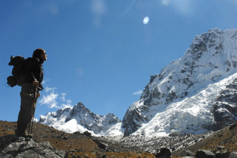
It’s not a technical climb. But it can feel hard. That sounds like a contradiction, and it kind of is—until you remember the main variable here: altitude. At the Abra Salkantay altitude, even “easy” walking can feel like a full-body meeting you didn’t schedule.
A quick roadmap (so you know where this is going)
- First: the key numbers (distance, high point, typical elevation gain)
- Then: what the elevation profile feels like day to day
- After that: altitude strategy (acclimatization, symptoms, smart pacing)
- Next: weather reality + seasons
- Finally: packing, training, costs, and a few “wish someone told me” tips
So… how high are we talking?
Let’s get the headline numbers out of the way. They’re not trivia—they’re your risk and energy budget.
- Salkantay pass elevation (highest point): most sources put Abra Salkantay around 4,600–4,650 m (GPS readings vary by trail and device).
- Total trek distance: many 5-day itineraries land around 60–75 km, depending on camps, detours (like Humantay Lake), and whether you hike all the way to Aguas Calientes or take a train for the last stretch.
- The big climb day: often a gain of ~700–800 m to the pass, followed by a long descent that can be tougher than it sounds.
When people search Abra Salkantay Peru, they often want a single “difficulty rating.” Honestly, it’s more like a project plan: altitude + weather + sleep + feet + logistics. One weak link can make the whole day feel messy.
The elevation profile, explained like a human
If you looked at a typical profile chart, you’d see a classic arc: ramp up, spike to the pass, then a long slide down into warmer terrain. But charts don’t show what your body notices—wind, cold fingers, a sudden headache, or the weird way your appetite disappears.
Day 1: The warm-up… that can sneak up on you
Many routes start somewhere around 2,900–3,900 m depending on where you begin and where you camp (Soraypampa is a common overnight). Day 1 is often described as “moderate.” Which is true—unless you go too hard, too soon.
If Humantay Lake is on the menu, it’s stunning. It’s also steep. Think of it like a bonus level in a video game: fun, but not required to finish the main quest. If you’re not well acclimatized, keep it slow or skip it without guilt. Your pass day self will thank you.
Day 2: The pass day (a.k.a. “Why is breathing a task?”)
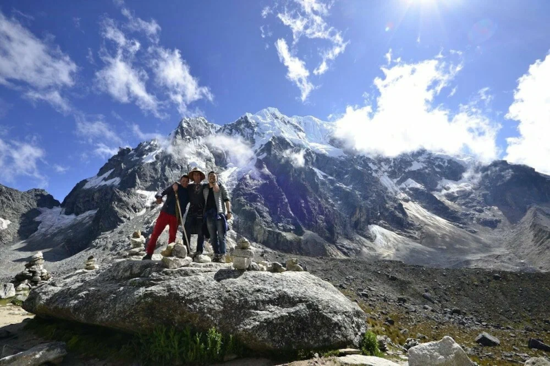
This is the signature day for the Salkantay pass Peru route.
- Start altitude: commonly around ~3,900 m (again, it depends on camp).
- Top out: ~4,630 m at Abra Salkantay.
- Then: a long descent into lower valleys, where the air feels richer and your knees start doing math.
Here’s the thing: at altitude, your “normal” pace is not your normal pace. You’ll see strong hikers stop every few minutes and pretend to admire the view. They’re not faking it. They’re managing oxygen supply like it’s a tight inventory system.
You know what? This is also where gear choices show up fast. Wet gloves, a thin jacket, or a sleeping bag that didn’t live up to its rating—those aren’t small annoyances anymore. They’re morale killers.
Days 3–4: Downhill, warmer, and deceptively demanding
After the pass, the route often drops toward 3,000 m and below. You’ll likely trade icy wind for humidity. Some trekkers feel a sudden energy surge (“Wait, is this… easy now?”). Great. Enjoy it. But keep an eye on your feet.
Long descents are where blisters bloom, toes get angry, and quads turn into two sore bricks. The work becomes more “ops” than “heroic”—steady pacing, snack breaks, and small fixes before they become big problems.
Day 5: The Machu Picchu logistics day
The final day depends on your itinerary: some people approach via Hidroeléctrica (a flatter, often hot walk), others connect by train, and some combine both. It’s usually not about altitude anymore. It’s about heat, time, and staying patient when you’re tired and excited at the same time.
Distance and pacing: what your day can look like
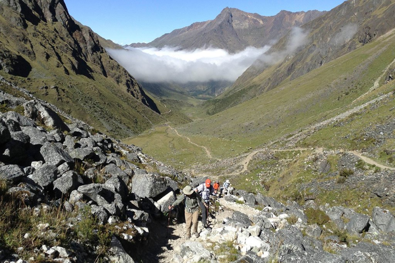
On a typical 5-day route, daily mileage often falls around 10–18 km. The pass day can take 6–10 hours on foot depending on conditions, group speed, and how you handle stops.
My favorite pacing rule is simple: short breaks, often. A one-minute breather every so often keeps your system stable. A long stop can leave you cold and stiff—especially near the pass.
Altitude: the part you can’t “tough out”
Most trouble on the Salkantay Pass isn’t from weak legs. It’s from bad altitude management. Fitness helps, sure. But acclimatization is the real KPI.
Acclimatize like you mean it
- Give yourself 2–3 nights before the trek, ideally with a gentle ramp: Sacred Valley (lower) first, then Cusco (higher).
- Do a light hike early on—something that gets you moving without crushing you.
- Hydrate steadily. Altitude can dry you out fast, even when you’re not sweating much.
If you’re thinking, “But I run marathons,” cool—your heart and lungs are in good shape. Your red blood cells, though? They didn’t get the memo. They need time.
Common symptoms (and what to do with them)
Mild symptoms can show up above 3,000 m: headache, nausea, poor sleep, a weird drop in appetite. Annoying, but manageable if they stay mild.
Red flags are different. If someone has severe headache that won’t ease, repeated vomiting, confusion, trouble walking straight, or shortness of breath at rest—stop and descend. That’s not drama. That’s basic safety protocol.
Also: talk to a clinician before your trip if you’re considering altitude medication (like acetazolamide) to prevent altitude sickness. While options like coca tea offer natural, mild relief, medication isn’t a magic shield—though it can help when used correctly.
Weather: expect mood swings (from the mountain, not you)
Conditions near Abra Salkantay can flip quickly. You can start in calm cold, hit a windy section that feels like a refrigerator door is open, then get bright sun that makes you unzip everything.
- Cold wind: common near the pass.
- Precipitation: snow, sleet, or graupel can happen, especially in shoulder seasons.
- Sun: strong at altitude—burns come fast.
Best time to go (and why shoulder season is tempting)
- Dry season (roughly May–September): clearer skies, colder nights, busier trails.
- Wet season (roughly November–March): greener scenery, more rain, more mud, and sometimes disrupted routes.
Shoulder months can be great: fewer crowds, decent weather windows, and that “lucky day” feeling when the mountains show off. But you have to pack for both sun and storm. No way around it.
Packing: keep it light, keep it smart
The Salkantay route is basically two climates stitched together. So think in layers, not single heavy items.
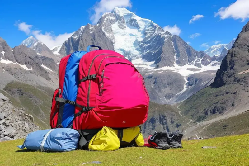
Clothing system (simple, effective)
- Base layer: moisture-wicking (skip cotton)
- Mid layer: fleece or light insulated jacket
- Shell: waterproof jacket; rain pants are a bonus when it’s sloppy
- Extras that matter: beanie, buff, gloves (wind-resistant gloves are a small miracle)
- Sun kit: sunglasses, sunscreen, hat
Feet: the real leadership team
Your feet are the decision-makers out there. Treat them like it.
- Broken-in shoes or boots with grip
- Quality hiking socks (bring backups)
- Blister care: tape + hydrocolloid patches + antiseptic
Cold nights (the “survival guide” part)
Many people underestimate the night temps near the high camps. If you’re relying on rentals, confirm details—don’t accept “It’s warm” as an answer.
- Sleeping bag: aim for a comfort rating around -5°C to -10°C (confirm what your operator provides).
- Liner: adds warmth and keeps things cleaner.
- Dry sleep layer: keep one set of clothes only for camp/sleep. Don’t hike in it. Protect it like it’s your phone.
Honestly, a warm night does more for your trek than an extra fancy snack. Recovery is the hidden engine.
Training: what helps (and what’s overrated)
If you’ve got 4–8 weeks, focus on the stuff that transfers well:
- Uphill time with a pack: hiking beats treadmill heroics.
- Stairs: steady sets teach your legs to keep going.
- Downhill practice: step-downs and controlled descents save your knees later.
- Time on feet: it toughens skin and builds “all day” stamina.
And yes, strength work helps. But the most underrated skill is boring: consistent pacing. That’s the whole game at altitude.
Salkantay vs. Inca Trail (a quick, honest comparison)
If you’re torn between the two, here’s the vibe check:
- Salkantay Trek: bigger mountain scenery, less regulated feel, more climate change along the way.
- Inca Trail: more ruins on the trail, stricter permits, a more structured experience.
Neither choice is “right.” It’s more like choosing between a road trip and a curated tour. Both can be amazing.
Cost and value: what you’re really paying for
Salkantay trek guided tour cost varies a lot. Instead of hunting the cheapest price, look for a solid support system. Ask about:
- Group size and guide-to-hiker ratio
- Meal quality (hot food matters when you’re cold)
- Gear quality: tents, sleeping bags, sleeping pads
- Pack/horse support and weight limits
- Contingency plan for altitude issues (horse availability, descent plan, communication)
This is where a little professional skepticism pays off. You’re not being difficult—you’re doing basic due diligence.
Pass-day tips you’ll actually use
- Start slightly cool. If you’re warm at the trailhead, you’ll sweat on the climb.
- Protect your hands early. Cold fingers can wreck your mood fast.
- Eat before you’re hungry. Appetite fades at altitude, but you still need fuel.
- Use poles if you can. Your knees will feel the difference on the descent.
- Don’t negotiate with worsening symptoms. If things get worse as you go up, the fix is usually down.
One last thought (because it’s easy to forget)
The Salkantay pass isn’t only about reaching a point on a map. It’s about moving well through a place that’s bigger than your plans. Some moments will feel smooth. Some will feel like a slog. That’s normal.
But when you hit that high notch—when the Salkantay pass elevation number on your watch is staring back at you—and the mountains are doing their quiet, dramatic thing? You’ll get it. And you’ll probably think, “Okay… that was worth it.”


