+51 980 852 691 +51 930 842 108 [ES] info@andeantrekkingperu.com Calle Marques 231 Int. 115. CC Sotomayor.
Contact Us

What is the elevation gain on the Inca Trail and why does it matter? 

Distance doesn’t tell the real story here. What is the elevation gain on the inca trail is the question that actually matters when preparing for this trek. Stone paths carved by ancient Incas wind through deep valleys, high mountain passes, cloud forests changing character every few hundred meters. Seasoned hikers underestimate it. First-timers get blindsided almost every time. 

Understanding the inca trail elevation gain before booking anything is what separates a successful trek from a genuinely miserable one. How high someone climbs, how thin the air gets, how well the body adapts to conditions it has never encountered before. That’s the real challenge here. Not the kilometers.

what is the elevation gain on the inca trail

The Geography of the Andes: Understanding the Starting Point

Flying into Cusco at 3,399 meters means feeling the thin air immediately stepping off the plane. What catches most people off guard is how the machu picchu citadel vs trail elevation works. The citadel itself sits much lower than Cusco, and significantly lower than the mountain passes crossed during the trek. Machu Picchu at around 2,430 meters. Highest point on the trail at 4,215 meters. The journey goes up hard before it comes down.

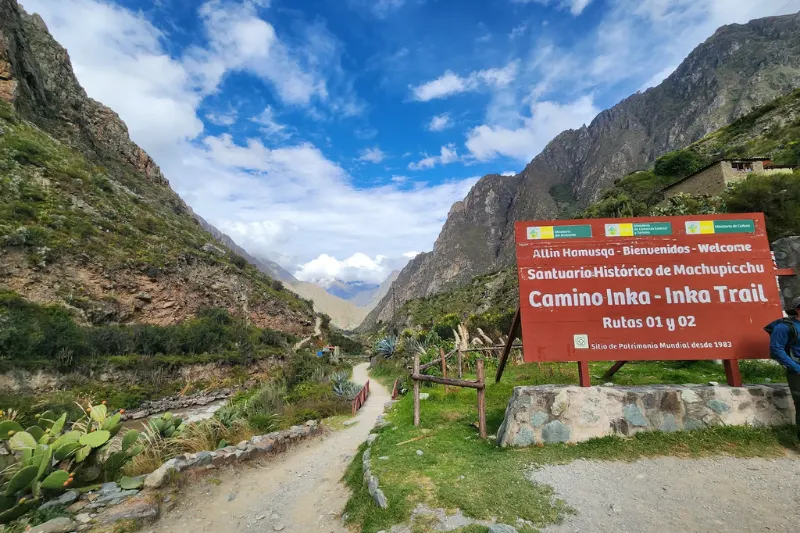
The cusco to trailhead altitude change matters practically before day one even starts. Kilometer 82, the official starting point, sits at roughly 2,600 meters after driving down from Cusco into the Sacred Valley. Thicker air at the beginning feels like a gift. It isn’t a reason for false confidence. The trail climbs hard and fast from there and doesn’t apologize for it.

Topographic map of the classic four-day route looks like saw teeth. Rarely flat. Climbing steep ancient stone staircases or dropping sharply into river valleys. Understanding daily trekking distance and vertical climb together is the foundation of every preparation decision.

Altitude affects your travel experience in ways that go beyond physical discomfort, it shapes the pace of every single day, determines how much can realistically be enjoyed versus merely survived, and influences decisions about which route makes sense for a specific traveler’s fitness level and timeline.

Inca Trail Elevation Gain by Day: A Detailed Breakdown

Hiking inca trail routes demands mental fortitude alongside physical fitness. Knowing exactly what’s coming each day allows proper pacing, energy management, and genuine mental preparation for the hard sections.

Day 1: The Gentle Introduction

  • Starting Elevation: 2,600 meters (8,530 feet) at Kilometer 82
  • Ending Elevation: 3,000 meters (9,842 feet) at Wayllabamba Camp
  • Elevation Gain: roughly 400 meters (1,312 feet)
  • Distance: 12 kilometers (7.5 miles)

Training day. Path undulates alongside the Urubamba River with a few steep sections earning the nickname Inca flats because nothing on this trail is ever genuinely flat. Overall vertical climb is manageable. 

Body still adjusting to reduced-oxygen exertion. Finding a rhythm, adjusting trekking poles, getting used to daypack weight. That’s what Day 1 is actually for. The relatively mild inca trail elevation gain here eases the body in before what comes next.

what is the elevation gain on the inca trail

Day 2: The Ultimate Test

  • Starting Elevation: 3,000 meters (9,842 feet)
  • Ending Elevation: 3,600 meters (11,811 feet) at Pacaymayo Camp
  • Elevation Gain: roughly 1,215 meters (3,986 feet) up, then a 600-meter (1,968 feet) descent
  • Distance: 11 kilometers (6.8 miles)

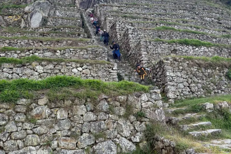
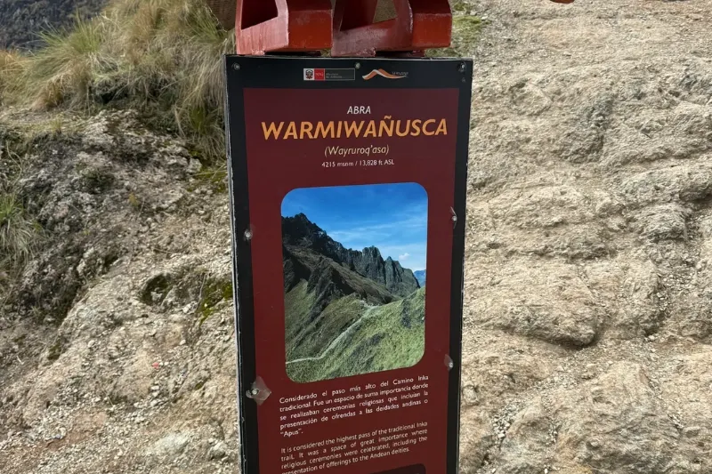
Universally the hardest day. Largest inca trail elevation gain in a single stretch, climbing toward Abra Warmiwañusca. Dead Woman’s Pass. The dead woman’s pass summit altitude sits at 4,215 meters, 13,828 feet. Highest point on the entire classic trail. Relentless ascent. Thousands of uneven stone steps through changing microclimates, dense humid forest giving way to barren wind-swept high-altitude grassland called the Puna.

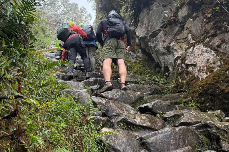
As the pass approaches oxygen levels drop noticeably. Every step heavier. Heart rate spiking at a pace that would feel easy at sea level. The mantra that gets people through this is poco a poco. Little by little. Frequent short breaks. No rushing. Cresting the summit produces one of the more emotional moments on any trek anywhere. Then comes a steep knee-jarring descent down to Pacaymayo campsite at 3,600 meters.

Day 3: The Longest Day of Ruins and Cloud Forests

  • Starting Elevation: 3,600 meters (11,811 feet)
  • Ending Elevation: 2,680 meters (8,792 feet) at Wiñay Wayna Camp
  • Elevation Gain: roughly 400 meters (1,312 feet) up, followed by a massive descent
  • Distance: 16 kilometers (10 miles)

Most ground covered. Multiple mountain passes, significant climbing, most archaeological content of any day on the route. Second pass, Runkuraqay, hits at 3,950 meters before the trail drops into lush emerald cloud forest.

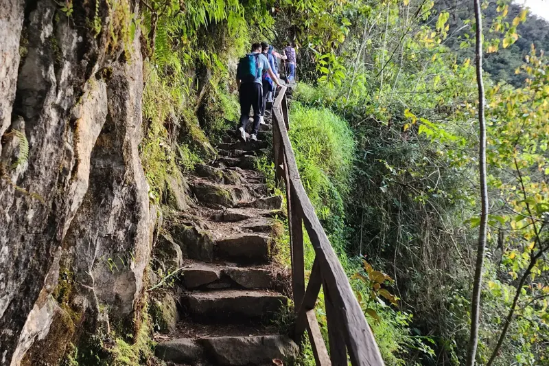
The Phuyupatamarca ruins height above sea level sits at approximately 3,680 meters, 12,073 feet, earning the name Town in the Clouds. Panoramic views of surrounding snow-capped peaks from here genuinely unmatched. After Phuyupatamarca comes roughly 3,000 steep Inca stairs descending into the high jungle environment. Lungs appreciate the thickening air dropping in altitude. Knees and quadriceps pay the cost of that trade.

Day 4: The Final Push to the Citadel

  • Starting Elevation: 2,680 meters (8,792 feet)
  • Ending Elevation: 2,430 meters (7,972 feet) at Machu Picchu
  • Elevation Gain: Minor undulating ascents, mostly downhill
  • Distance: 5 kilometers (3.1 miles)

Final day starts well before dawn. Short narrow trail carved into the mountainside leading to Inti Punku, the Sun Gate. Brief set of steps called the Gringo Killers right before the gate. Worth knowing about in advance rather than encountering without warning mid-exhaustion.

Through Inti Punku the citadel appears below. The machu picchu citadel vs trail elevation comparison makes itself felt immediately. At around 2,430 meters breathing suddenly feels effortless compared to the previous three days. 

The altitude challenge is finished. From here the top attractions near Aguas Calientes become accessible, the thermal baths, the Museo de Sitio Manuel Chávez Ballón holding artifacts excavated directly from the site, the Urubamba River restaurants, all of them waiting in the town below after the trek concludes.

The Physiology of Altitude: What Happens to Your Body?

Atmospheric pressure decreases as elevation increases. Air still contains 21% oxygen but molecules spread further apart. Every breath delivers less oxygen to the bloodstream than the body is used to receiving.

The Reality of Oxygen Saturation

Healthy oxygen saturation at sea level runs between 95% and 100%. Oxygen saturation on the camino inca can drop into the 80s or high 70s depending on the individual and specific elevation. Coping with low oxygen levels while walking is the central physical challenge. Body compensates by breathing faster and deeper, heart pumping harder to circulate limited oxygen to vital organs and muscles. A pace feeling like a slow stroll at sea level can feel like a full sprint at 4,000 meters.

The Threat of Altitude Sickness

Soroche, altitude sickness, occurs when the body struggles to adapt to lower oxygen. Symptoms range from mild to severe, headaches, nausea, dizziness, fatigue, shortness of breath, loss of appetite. Preventing soroche during Andean treks isn’t optional. Severe cases like High Altitude Pulmonary Edema or High Altitude Cerebral Edema are life-threatening and require immediate evacuation to lower altitude.

Prevention strategies:

  • Hydration: High-altitude air is incredibly dry. Three to four liters daily minimum on the trail. Lose significant water simply by breathing at this elevation.
  • Nutrition: Carbohydrate-rich meals. Carbohydrates require less oxygen to metabolize than fats or proteins, making them ideal high-altitude fuel.
  • Medication: Many trekkers consult doctors for Acetazolamide, Diamox, which speeds acclimatization significantly.
  • Coca tea: Mate de coca used by indigenous Andean cultures for millennia against altitude symptoms. Mild stimulant, helps alleviate stomach discomfort and headaches consistently, available everywhere in Cusco and along the trail itself.

what is the elevation gain on the inca trail

Mastering the Acclimatization Process

Altitude can’t be trained for at sea level. The fittest marathon runner and the casual weekend hiker are equally susceptible to altitude sickness. Acclimatization depends on genetics and proper preparation rather than fitness level.

Most important acclimatization tip for high altitude hiking is climb high, sleep low. Pre-trek preparation is where real control actually exists.

Where to Acclimatize: The Sacred Valley Strategy

Most tourists fly directly from sea-level cities into Cusco at 3,399 meters. Thin air hits immediately. Experts strongly recommend acclimating in the Sacred Valley before hiking rather than staying in Cusco from day one.

Towns like Ollantaytambo, Pisac, and Urubamba sit between 2,700 and 2,900 meters. Leaving Cusco immediately for the Sacred Valley gives the body a gentler environment to begin producing extra red blood cells. Standard safe pre-trek itinerary:

  • Day 1: Arrive in Cusco, immediately transfer to the Sacred Valley. Rest.
  • Day 2: Explore Sacred Valley ruins with light walking.
  • Day 3: Travel up to Cusco or Chinchero for a day tour at higher altitude, sleep back in the valley.
  • Day 4: Rest in Cusco, hydrate, organize gear.
  • Day 5: Begin the Inca Trail.

Three full days of acclimatization before starting drastically reduces severe soroche risk. The body needs time to alter blood chemistry. Rushing this process is the single most avoidable mistake on the entire trip.

Preparing Your Body: Training for the Terrain

Physical lung capacity can’t be trained at sea level. Muscles, joints, and cardiovascular system absolutely can be prepared for the relentless terrain. Understanding how to train for steep mountain ascents separates an agonizing trek from a challenging but enjoyable one. The best time to trek the inca trail is May through September during the dry season, which gives the best trail conditions and clearest skies, and training should begin at least three to four months before whatever departure date gets locked in.

Cardiovascular Conditioning

  • Long Hikes: One long hike per week, progressively increasing distance and elevation gain. Best training for hiking is hiking.
  • Incline Treadmill/Stairmaster: 45 to 60 minutes on the Stairmaster with a weighted backpack if flat terrain is the only local option.
  • Cardio Intervals: Running, cycling, or swimming to build lung capacity and improve heart stroke volume.

what is the elevation gain on the inca trail

Strength Training

  • Squats and Lunges: Weighted squats, walking lunges, step-ups. Step-ups on a plyometric box mimic the ancient stairs directly.
  • Eccentric Training: Descending from high passes hurts more than climbing them. Focus on eccentric movements, the lowering phase of a squat or step-down, to prepare legs for downhill trekking.
  • Core Work: Planks, Russian twists, stability exercises protecting the lower back from backpack strain across multiple days.

Wear Your Gear

Don’t let the trek be the first time gear gets tested. Break in waterproof hiking boots months in advance. A blister on Day 1 can ruin the entire trip. Train with the exact daypack planned, loaded with 3 to 5 kilograms, so shoulders adapt to the weight before the trail demands it.

Choosing Your Path: Inca Trail or Short Inca Trail

Not everyone has four days, the physical capability, or the desire to spend nights camping in the high Andes. The decision between the Inca Trail or Short Inca Trail comes down to available time, fitness level, and how much altitude punishment someone is willing to take on.

The Classic 4-Day Trek

  • Total Distance: 43 kilometers (26 miles)
  • Max Elevation: 4,215 meters (13,828 feet)
  • Accommodation: Tents and camping
  • Difficulty: Strenuous. Excellent physical fitness, mental resilience, and thorough acclimatization required. Three distinct high-altitude mountain passes.

The Short 2-Day Trek

  • Total Distance: roughly 12 kilometers (7.5 miles) hiking on Day 1, Day 2 dedicated purely to touring Machu Picchu
  • Starting Elevation: Kilometer 104 at 2,100 meters (6,890 feet)
  • Max Elevation: 2,720 meters (8,924 feet) at the Sun Gate
  • Accommodation: Hotel bed in Aguas Calientes
  • Difficulty: Moderate

The Short Trail bypasses the grueling high-altitude ascents entirely. Train to Kilometer 104, hike through cloud forest to Wiñay Wayna ruins, connect to the final stretch toward the Sun Gate. Maximum altitude under 2,800 meters means significantly lower altitude sickness risk, thicker air, warmer temperatures, reduced physical toll. Ideal for families with older children, older adults, or anyone unwilling to endure Dead Woman’s Pass. Still involves several hours of steep uphill stair climbing though. Physical preparation still matters regardless of which route gets chosen.

what is the elevation gain on the inca trail

Essential Gear for Elevation Challenges

Trekking Poles

Non-negotiable for this elevation profile. During steep ascents, poles use upper body strength to pull upward, taking up to 20% of weight off leg muscles. During brutal descents like the 3,000 steps dropping from the third pass, poles act as shock absorbers saving knees and ankles from significant cumulative impact forces.

Layering Systems

High altitude means volatile weather. Sweating in a t-shirt during direct sun climbing, freezing when a cloud rolls in at a windy mountain pass. Same day, sometimes same hour.

  • Base Layer: Moisture-wicking merino wool or synthetic. Never cotton. Cotton traps sweat and causes dangerous cold in mountain conditions.
  • Mid Layer: Fleece or down jacket trapping body heat during rest breaks and cold sections.
  • Outer Shell: Windproof and waterproof jacket and pants for harsh Andean squalls that appear without warning.

Hydration Bladders

Stopping to pull a water bottle out breaks rhythm, costly when struggling for breath on a steep climb. A hydration bladder with a hose allows small frequent sips without stopping momentum. Constant hydration is the primary defense against altitude sickness throughout the entire trek.

Mental Fortitude: The Unseen Requirement

Maps, distances, biology, training. All of that matters. But there’s an intangible element required to get through the inca trail elevation gain that can’t be trained directly: mental toughness built from knowing what’s coming.

Somewhere halfway up Dead Woman’s Pass on Day 2, lungs burning, legs feeling like lead, the summit looking impossibly far away, thin air playing tricks on the mind. Panic or extreme fatigue sets in for a lot of people at that exact point without exception.

That’s where mental preparation takes over. Hundreds of thousands of people walked those exact stones before. The training and acclimatization days invested beforehand are working even when it doesn’t feel that way from inside the experience. Guides trained specifically to monitor health and adjust pace when needed.

Break the mountain into micro-goals. Not the summit. A rock twenty feet ahead. Commit to reaching it. Then pick the next one. Matching breath to footsteps rhythmically creates a meditative state that allows pushing through physical discomfort that would otherwise stop someone entirely.

The Reward at the End of the Climb

Everything, the sweat, the breathlessness, the burning muscles, culminates in one of the most specific moments available to a traveler anywhere in the world. Final morning, pre-dawn darkness, hiking toward Inti Punku. Sun rises over surrounding peaks. Mist clears. Ancient citadel of Machu Picchu appears illuminated below.

Because the high passes were traversed, the thin air was battled, and the actual stones laid by the Inca Empire were walked for days, arriving at the citadel isn’t a sightseeing tour. It’s a hard-earned pilgrimage. The sense of accomplishment looking down at those ruins connects directly to every elevation challenge overcome to stand in that exact spot at that exact moment.

what is the elevation gain on the inca trail

FAQs

What is the elevation gain on the Inca Trail?

What is the elevation gain on the inca trail depends on the specific itinerary and how cumulative ascent gets calculated. The biggest single climb is Day 2, gaining about 1,215 meters, 3,986 feet, on the way up to Dead Woman’s Pass.

What is the maximum altitude on the Inca Trail?

Dead Woman’s Pass, Abra Warmiwañusca, at 4,215 meters, 13,828 feet. Highest point on the classic route.

What is the Inca Trail elevation gain by day?

The inca trail elevation gain by day on the classic route runs roughly 400 meters on Day 1, about 1,215 meters on Day 2 with a major descent, about 400 meters of climbing on Day 3 with multiple ups and downs, and mostly minor undulating terrain on Day 4.

Is hiking the Inca Trail mostly uphill?

Hiking inca trail routes is a mix of steep ascents and steep descents rather than one continuous climb. Long stair sections, rolling ridge lines, and significant downhill stretches into valleys and campsites throughout all four days.

Does the Short Inca Trail have the same elevation challenge?

No. The 2-day option avoids the high passes entirely. Its highest point is around 2,720 meters, 8,924 feet, at the Sun Gate. Elevation challenge significantly lower than the classic inca trail trek.

Conclusion

Understanding and preparing for the inca trail elevation gain is the single most important factor determining whether the trek is enjoyable or genuinely miserable. The journey was designed as a sacred pilgrimage meant to test devotion. That challenge is fully intact centuries later.

The best season to visit Peru for the Inca Trail is May through October, the dry season, when skies are clear, trails are stable, and the high mountain passes cooperate more reliably than during the wet months. Knowing the day-by-day vertical climbs, committing to a training routine built around steep ascents, and strategically acclimatizing in the Sacred Valley before starting equips the body for the harsh Andean environment. 

Listen to the body. Respect the altitude. Stay hydrated. Take it poco a poco. The ancient path demands everything available. What it gives back in return, standing at Inti Punku watching the mist clear over Machu Picchu, stays with people permanently.